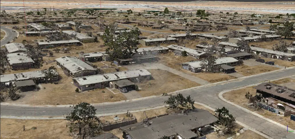
George AFB Data Review
George Air Force Base is a former United States Air Force base located within the city limits of central Victorville, California and about 75 miles northeast of Los Angeles, California. George Air Force Base was officially decommissioned in December 1992. In 1993, President Bill Clinton announced a “Five Part Plan” to speed economic recovery in communities where military bases were to be closed. One part of this plan called for improving public participation in the base’s environmental cleanup program. George AFB was among several installations where environmental cleanup was placed on a “fast track” so base property could be quickly transferred to the community for reuse. While the base remains closed, local rumors continue of the Wherry housing units being haunted. (source: Wikipedia)
There’s an excellent urban explorer video on YouTube which can be viewed here.
The George AFB Data comprises the main focus of a detailed tutorial, Environment Scanning for VFX covered later in masterclass coursework and due for early-access release in mid-December 2024.
Cesium Preview of Mavic 3E Aerial Survey
Cesium Mavic 3E Aerial Survey (5cm GSD)
The George AFB Data set contains over 800gb of raw data, processed data and project files (Metashape) from the following sensors:
- DJI Mavic 3E Enterprise
- Emlid RS2+ GNSS
- Navvis MLX
- Navvis VLX3
- Leica Geosystems BLK360g2
- Sony A7r3 DSLR
- Kandao Qoocam Ultra 3
